Showing posts with label Adventures. Show all posts

Thursday, 4 December 2014

Gem Gin Mule - A bushwalking cocktail

Created for the November 2014 ANUMC Cocktails on the Castle, this cocktail is a balanced mix of sweet mint with sharp citrus and spicy ginger.
Gem Gin Mule
  • 1      oz   mint syrup (see below)
  • 1.5   oz   gin
  • 2      oz   green ginger wine
  • 0.75 oz   fresh lime juice
Combine all ingredients in a shaker with ice. Strain and serve.

Mint Syrup
  • 1   cup   water
  • 1   cup   granulated sugar
  • bunch fresh mint
Combine sugar and water in a saucepan over low heat. Stir until sugar is dissolved and allow to cool.
Muddle mint leaves with a few spoons of the cooled sugar syrup. Add remaining syrup, cover and steep for a day. Strain through fine sieve or filter before use. 

Black Gingerberry Smash - A bushwalking cocktail

Don't forget to take a suitable
vessel up the mountain with  you.
Created for the November 2014 ANUMC Cocktails on the Castle, this cocktail balances sweet liqueur with sharp citrus and spicy ginger.
Black Gingerberry Smash
  • 1      oz   ginger syrup (see below)
  • 0.25 oz   black raspberry liqueur
  • 1.5   oz   gin
  • 1.5   oz   apple cider
  • 0.75 oz   fresh lemon juice
  • apple slice (optional)

Combine all syrup, liqueur, gin and lemon in a shaker with ice. Strain into glasses and top with cider. Optional: Add an apple slice as garnish.


Ginger Syrup
  • 1   cup   water
  • 1   cup   granulated sugar
  • 4   cm    sliced fresh ginger
Combine sugar and water in a saucepan over low heat. Stir until sugar is dissolved and allow to cool.
Muddle ginger slices with a few spoons of the cooled sugar syrup. Add remaining syrup, cover and steep for a day. Strain through fine sieve or filter before use.

Ginger Cocktails - Bushwalking Style

(To jump straight to the recipes, go to Gem Gin Mule and Black Gingerberry Smash)
In honour of the Australian Mountaineering Club’s new ginger president (the first ginger president the club has seen this millennium), the recent Cocktails on the Castle event had a red theme. This meant finding red clothing for the cocktail party outfits, and preferably finding some form of red/ginger theme for the food and drinks. For a full description of this mildly absurd and thoroughly brilliant club tradition, see the Words and Wilds blog entries about the last two that have been held (The Heatwave Edition and The Red Promenade) and Hills to Hoists’ comic post about November's trip.

In a car group with two people who both had functioning ovens (mine is presently undergoing repairs) and plans to make various dishes for the main courses to be served atop the Castle, I turned my attention to making ginger-themed cocktails instead. There’s no lack of cocktails featuring ginger in one form or another, but I had further restrictions to place on them. They had to suit the drink preferences of said ginger El Presidente (a balance of sweet with sour citrus - no great challenge), and be something that could be made en mass atop a mountain in the middle of a national park after its ingredients had been dragged up its slopes in a heatwave. Much trickier.

Original Gin Gin Mule recipe, pre-modification
Inspired by a Gin Gin Mule I had tried at Molly in Canberra, I tried to adapt this rather delightful cocktail to the outdoors. Muddling mint was possible, but impractical if I wanted to both provide cocktails for more glasses than mine and do more during the evening than crush mint leaves. The ginger beer was another problem. Glass bottles and bush-walking don’t mix, so I was decanting everything into plastic. Commercial ginger beer that’s already in plastic is readily available, but has no discernible trace of ginger even without being mixed. Decanted ginger beer rapidly loses its appeal as the fizz fades away. So I crushed mint leaves back in Canberra and left them to steep in sugar syrup.  The evening before we left, I passed the syrup through a pourover coffee filter and chilled it to survive the following day’s walk in the heat. For the ginger flavour, I delved back into my early university memories of drinking with the Tasmanian University White Water Rafting Club, and withdrew a bottle of Stones Green Ginger Wine. Unlike ginger beer, it doesn’t change flavour when decanted and shaken in a pack at 30+ degrees for a day. It also has one of the strongest ginger flavours that you can find in a commercial beverage. A drop of red food colouring in the gin to reinforce the reference to the party’s theme, some fresh limes (there’s just no substitute worth using) and I had one seriously tasty cocktail ready to go, the newly dubbed Gem Gin Mule in homage of the Stones at its core.

Original Ginger Smash recipe, pre-modification
Of course, one cocktail hardly seemed adequate. I searched further, and found another promising recipe, just waiting to be adapted to an absurd bushwalk. The Ginger Smash (or at least one version of it, for there are many) is another cocktail requiring plenty of muddling, but testing a few days before we left showed that preparing a second syrup and steeping slices of crushed fresh ginger made an excellent substitute. The original recipe also called for cranberries, which (while providing a nice red shade to the finished drink) were not exactly optimal for bushwalking. I tried swapping them out for a splash of Chambord Black Raspberry liqueur, in part because I had a bottle just begging to be used, and found it a satisfactory replacement. Cider was easy to use without substitution; unlike ginger beer, there are a few good ciders available in cans. The resulting combination proved to have a most pleasing flavour, that was entirely different from the Gem Gin Mule in spite of them both being gin-based ginger and citrus cocktails. Ideal.


Friday, 23 May 2014

A Posting Lull

Some may have noticed a distinct lack of posts appearing here of late. There is good reason for this and for once it's not that I'm being lazy. I've been thoroughly snowed under by the competing commitments of SES training, study, arranging new club ski gear and lessons for the encroaching season, and still trying to have the occasional adventure in between. While staying up until 2am most nights before it all resumes again a few hours later, time to write about any of this has been limited.

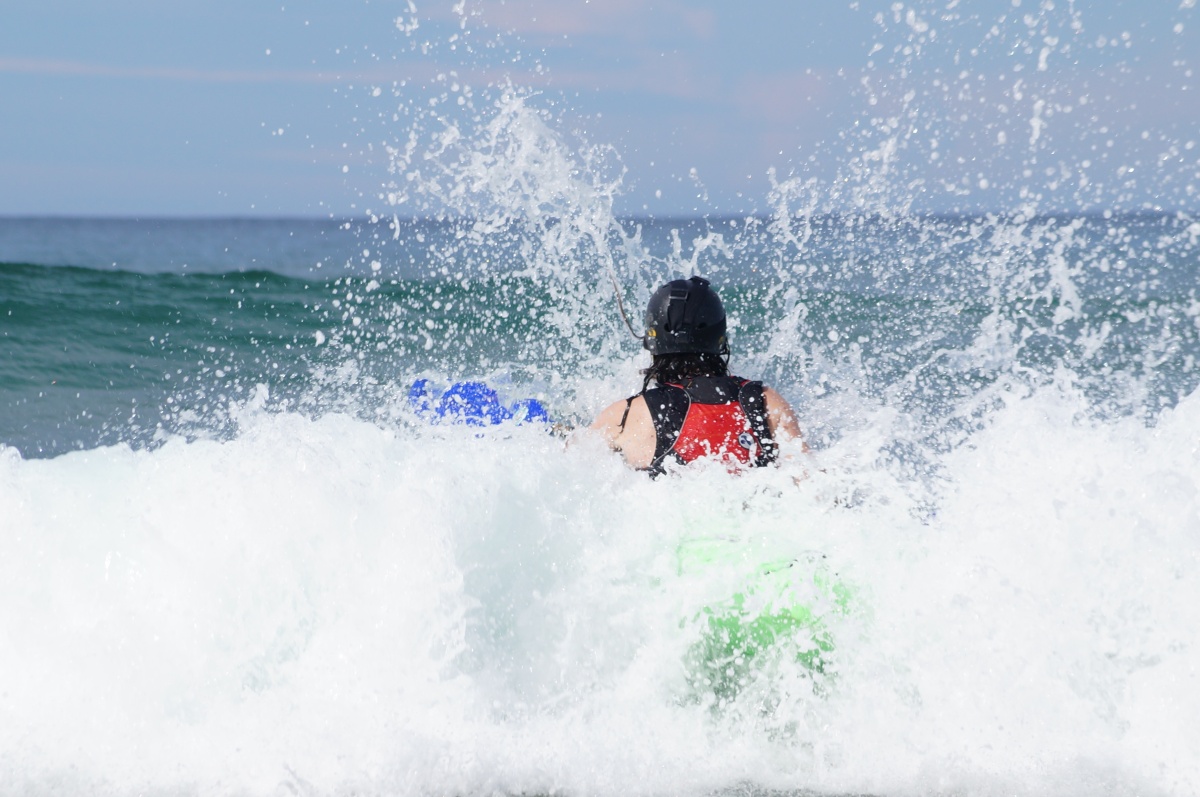
Fortunately, Jessica from Words and Wilds has been on most of the same trips as me, and is documenting them on her blog! The most recent of these includes a few of her excellent photos, depicting me being crushed by waves while trying to surf in a most unfamiliar way. It's a good read and includes some pretty photos of people floundering in the waves.

Tuesday, 8 April 2014

Bowens Creek Canyoning

Day 2 of the 2014 Blue Mountains Extravaganza brought with it further predictions for rain, thunderstorms and possibly the apocalypse itself. The forecast had lost some credibility with us after the previous day's adventure had been relocated for fear of a storm that never came, but the terrible consequences of a flash flood while canyoning meant we still couldn't take the risk. Fortunately, we were intending to make our way down a canyon more forgiving than Claustral, and our plans could go ahead.

Photo courtesy of Jessica RoseThere are several canyoning sections in Bowens Creek (some of them with overlapping names) but it was on Upper Bowens Creek South that we set our sights. It was a new canyon for all of us, but its trip description had caught the eye of our intrepid leader. Starting with a car shuffle (to save us a 3km walk along the non-existent verge of a highway at day's end), we packed and set out along a ridgetop pad toward the start of the canyon. I've had difficulty looking for entry points to some canyons (most notably when spending half a day bush-bashing while trying to find Heart Attack canyon) but the pad took us most of the way without drama, and a steep scramble soon took us the rest. These muddy stretches of rock proved the most treacherous footing of the trip, quickly clogging the tread on our volleys* as we grasped at tenuous handholds.

A short jaunt alongside the creek brought us to the start of the wet sections, and a convenient campsite carefully cut into the hillside where we could don wetsuits. Most of the abseils on the section could be scrambled around, but they were more than spectacular enough to be worthwhile. The first abseil was also the least impressive, a two-tiered waterfall before we reached the canyon proper. Jess used our second line to set up herself and her camera up between the two tiers, although the drops constantly spattering the filter over her lens soon drove her away.


Photo courtesy of Jessica Rose
From there, we worked our way down to the first constricted section, accessed from an abseil that plunged into a deep pool alongside a waterfall. The banded sandstone walls of the narrow canyon arched in graceful curves up to the distant slit of sky. It was a short section before we emerged onto an open sunlit platform that marked the start of the next abseil. This one dropping through a waterfall into an even grander chamber of vaulted sandstone, its soft greens and bands of vivid orange revealed by lances of sunlight that slipped between the trees and rocks above.

Photo courtesy of Jessica Rose
We left our packs and wandered a short distance up the less grand but equally beautiful Corkscrew canyon. It was relatively easy to go back up the canyon, and we would have explored further had time allowed it. Another time perhaps.

Beyond the junction, the canyon opened wide once more to reveal forest bordered by sheer sandstone cliffs. A snack break in the dappled shade of a stand of Coachwoods, and we ventured onwards once more. Another canyon joined ours unnoticed in the forest, until we realised the water was suddenly flowing the wrong way. A quick backtrack found the right path again, and brought us to the next abseil. We avoided this one, not because we didn't want to do the abseil, but because our leader spotted what looked like a cave opening that might offer an alternative route. Some scrambling with handlines followed as we edged through his mysterious path and did indeed emerge near the base of the abseil.

A log slide descended into the next pool, an intruding sandstone buttress halfway down navigated with mixed success. While hanging sideways off the log, most ended up dropping into the pool below. Wading onwards, we soon found Hobnail canyon cutting into our path. We dropped packs again and went for an explore. It was similarly promising, but our time still didn't allow us to complete an entire extra canyon in reverse. Working back down to our packs, I managed to trip myself up. An outstretched hand saved me from the indignity of falling into the water, but the sudden shooting suggested what might have been a worse outcome. A few cautious prods and pulls at my right thumb produced some quite unfortunately familiar sensations. I'd partially torn my UCL a few years previously while skiing in New Zealand, and did not relish the prospect of going through the same recovery process again. Still, there was nothing to be done for it then but to keep my right hand out of the way and use my left for the steep scramble and climb out of the canyon. Fortunately, I've long been in the habit of practicing doing activities one handed so it wasn't too major a hindrance, which was kind of the point of all that practice. I'm not sure that I'm glad that it paid off, but at least it stopped my thumb putting a dampener on the end of what had been a superb, storm-free day of canyoning.

Photo courtesy of Jessica Rose
* I wrote at some minor length last year about my disgust with the new line of volleys, and have since been searching for my ideal replacement canyoning and watersports footwear. Although the matter remains unresolved for now, the deadline was recently extended when I managed to find a new pair of genuine Dunlop Volleys. They were tested on Malaita Walls and Bowens Canyon, proving their mettle by surviving with tread unscathed.

Related posts:
Prelude: Blue Mountains Extravaganza 2014
Day 1: Claustral Canyon

Check out Jessica Rose's blog for more amazing photos.

Monday, 7 April 2014

Claustral Canyon: A mission thwarted

Claustral Canyon, coveted and revered for its reputation as both a challenging and spectacular canyon. It’s a long day, particularly since a change to the access route added a few hours on to the walk-in. It’s also been the site of numerous rescues and the tragic loss of a group of canyoners. Why? After two abseils down waterfalls, the third abseil starts by plunging through a small opening in the rocks, known as the keyhole. In the slot canyon, any rainfall can raise the water level to block the keyhole, trapping canyoners with waterfalls behind as the water rises.

Claustral canyon is dangerous with even the prospect of rain, and we had to know just what odds we faced before attempting it. Rising long before dawn on Saturday morning, we gathered around smartphones that struggled for reception in the depths of Megalong Valley. When a brief signal broke through, it illuminated the stark reality of our situation. Possible thunderstorms were predicted throughout the mountains.

Thunderstorms are the great enemy of canyoning, causing flash floods to roar unexpectedly through the narrow slots cut into the sandstone mountains. Even short canyons can be deadly if a storm crosses through their catchment. A long day in a slot canyon with no escape routes and a compulsory abseil that could be easily flooded was out of the question. There were a few bad weather alternatives available. We chose one that I had used before when storms swept across the mountains.

Malaita Walls is a popular abseiling destination near Katoomba. A multi-pitch abseil down the cliffs rather than a canyon, it has zero chance of flash-flooding, some spectacular views, and is utterly exposed in both senses of the word.


We donned harnesses, piled ropes into our packs and set off down the short access track. It brought us to the mass of chains that make up the first anchor, some leading to bolts, others wrapped around rock formations. It’s one of the most substantial anchors I’ve used, reassuring when swinging over the edge of a 70m cliff, with unobstructed views of the valley below. Leaning out and looking down, you can see a rock outcrop 45m below you, the end of the first pitch. At least, you can usually see an outcrop.

Although the skies were clear overhead, fog filled the valley below us. Stepping off the edge to start the abseil, my destination was hidden by the swirling vapours below. Although I knew it was there, and that four people had reached it safely ahead of me, I was struck by a sudden spike of fear when confronting that wall of white. 

My old fear of heights has largely been scared away since I started abseiling. It could only withstand so many instances of me stepping off cliffs and throwing myself past overhangs to dangle in the open air. Occasionally though, its remnants rear their head. Descending, knowing I had to swing to the side but unable to see my destination, I had the mixed sensations of serenely descending through the tranquillity of a beautiful setting and the internal screaming from part of me that was convinced I was going to fall into that unknown at any moment. That juxtaposition is quite possibly what I love most about abseiling.
It was an uneventful descent, the mists punctured by the constant calls of an army group on the neighbouring route of Malaita Point. Their shouted communications echoing down the valley gave an impression of a well organised and professional group... although this impression was somewhat dampened by a call of "You're on pitch four, numbnuts!" and the distinctly audible argument that followed.

Our own abseils went smoothly, including the usual dry-canyoning balancing act of not moving too painfully slowly, but also not going so fast that out ATCs would heat up and melt the dry rope.

Photo courtesy of
Jessica Rose.
Emerging onto the tourist trail at the end of the route, we started making our way back up the seemingly endless staircase that snakes its tortuous way up cliffs that are far easier to abseil down. A lookout at the base of a waterfall provided a break for lunch, and led us to contemplate abseiling the falls.

Photo courtesy of Jessica Rose.
Distractions and temptation to go straight back down the cliff aside, we did reach the clifftop tourist centre eventually and made for another tourist destination. A quick check of a Norwegian weather forecast showed we were in the clear for a brief dabble in a wet canyon, and we were soon donning wetsuits for a trip down Empress Canyon. The canyon is packed with tourists during the late morning and early afternoon, but was quiet by the time we entered the water. Starting higher on this trip than on my last trip, we got in an extra couple of jumps before reaching the main trail head.

Empress Canyon has a nice mix of jumping, scrambling and sliding, all within its beautifully sculpted, narrow confines. My white water instincts kicked in partway down, screaming that it was not appropriate to scramble through a boulder sieve just because the water made it look easy, but it was otherwise uneventful. The canyon ends with an abseil down a waterfall, dropping straight into a waterhole that's a popular destination on a hot summer's day. I had missed the abseil on my previous trip, and did so again on this one. Worried about being caught behind a traffic jam at the top of the abseil, we'd left harnesses and rope in the cars. By the time we reached the anchors, there was no chance of having to queue up; the area was deserted. But, without any gear, we had to turn around and scramble back up the canyon to the access track. It was no great chore, since canyons are as much fun to go up as down, but the abseil will continue to taunt me until the next storm is forecast on a canyoning weekend.

Related Posts:

For another take on the days events, not to mention some excellent photos, check out the trip report on Words and Wilds.

Monday, 24 March 2014

Blue Mountains Extravaganza 2014

A campsite sits tranquil and calm, a bare handful of campers spread out across the wide clearing. The air lies cool and still, laden with the promise of rains to come, but content to hold back its damping mists for now.

Gravel crunches, light flaring and sending shadows dancing through and around the trees. A car swings off the road, headlights sweeping across the campsite as it weaves its way to a halt. The engine’s rumble cuts off, plunging the campsite back into silence. Serenity returns, darkness creeping in to cover the camp once more.

Another droning engine cuts through the night, then another and another. Trickling slowly at first, but soon rising to a torrent, they stream into camp. Headlights blossom, chasing the shadows and pushing them back into the trees. People are everywhere, the beams of their headtorches rounding up the remaining shadows. All remnants of tranquillity are gone; the ANU Mountaineering Club has arrived in force.

The Blue Mountains Extravaganza is one of several annual mass-migrations from Canberra, filled with adventure seekers. In winter, they migrate south to the frozen landscape of the Snowy Mountains, bearing skis and crampons. Late spring sees them carrying their cocktail dresses and suits into the Budawangs. Summer finds them in Namadgi, feasting atop Baroomba. Autumn carries them east to the coast with kayaks and climbing shoes in tow. In the shoulder season, as summer relinquishes its grip, the pilgrims seeks the Blue Mountains with every canyoning and climbing rope they have. A long weekend in the ACT provides ample incentive for the trip, while a lack of a corresponding public holiday in NSW means the mountains aren’t overly crowded. Perfect.

The basecamp location changes every few years, meandering between those large enough to contain the mass arrival of cars and people. There are many such campsites, of course, but few that are conveniently close to canyons, sport and trad climbing, but aren’t so far down back roads that the convoy arriving late on Friday night risks getting lost on the way there. This year’s choice was Megalong Valley, near the town (and bakeries) of Blackheath.

Every morning for three days, a dozen different trips set off into the surrounding wilderness, a scatter of beginners among participants largely made up of trip leaders. This is their weekend, a chance to plunge into a canyon that’s been lurking on their to-do list for a few seasons, spend a day working on a multi-pitch climb whose top has thus far eluded them, or enjoy the novelty of taking part in someone else’s trip. There are still beginner trips but, more so than on most mass-pilgrimages, they are in the minority.

Attending with virtually no canyoning experience in 2013, I had spent most of my weekend on two beginner-friendly bushwalking trips. This year, I was preparing myself for a few new challenges. Among the many trips on offer, most of them heading to destinations on my to-do list, I set out with the aim of conquering Claustral Canyon, BowensCreek, and doing my first lead climb at Dam Cliffs.

Tent pitched after the long after-work drive, and the weekend ahead filled with the promise of adventure, I slept soundly on Friday night... at least until the alarm raised its voice in the darkness, a harbinger of troubles to come.

Day 1: Claustral Canyon

Day 2: Bowens Creek

Wednesday, 22 January 2014

2013 - A year in video review

So, it's been quite some time since my last post. First there was Christmas (whose adventures now need to be belatedly recorded here) and then I spent a few weeks trying to remember how to use the video editing software that had been gathering dust on my computer. My partner and I had gathered all our raw video footage from the year and set each other the challenge of compiling something from it.

Compiling, it turned out, was easier said than done, but nothing against the challenge of getting my old CS4 version of Adobe Premiere to output a usable file. I had forgotten the suffering that entailed. But it is done at last, and I've uploaded it to the interwebs for the judgement of the world.

2013 - A Year's Adventures from Nick Ward on Vimeo.

Thursday, 17 October 2013

Canyons and Bushbashing on a Blue Mountains Adventure

There isn't much canyoning down in Tasmania, and I'd only done it twice (both times entirely accidentally) on my home isle before moving to Canberra. The first time, I wound up on top of a cliff wishing I had a rope I could use to get to the bottom and ended up shimmying down a tree. The second was a 1:1 gradient quartzite stream that I descended while wearing walking boots and a 25kg pack. With such promising beginnings in the sport, it's small wonder I wanted to try canyoning with people who know what they're doing.

On the March long weekend this year, I ventured up into the Blue Mountains with a group of ANUMC bushwalkers, mountain-bikers, rockclimbers and canyoneers. While I spent most of the weekend bushwalking, I did take a day off to don my wetsuit, five-fingers and helmet then proceed to jump and slide my way down Twister and Rocky Creek canyons. I discovered, in that one activity, something that tested several of my phobias: claustrophobia, acrophobia and nyctophobia. Now if you don't handle fear the way I do, I can understand why you'd think this meant I didn't enjoy myself. Actually, I loved it. Pitching myself against things that terrify me has thus far proved an effective way of becoming less terrified of them afterwards and enjoying myself while I'm at it.

So I signed up to the next canyoning trip I could join, which promised a nice 60m abseil to put my acrophobia to the test. I donned wetsuit, volleys, helmet and harness and prepped myself for the terror. It was annoyingly easy, thanks to some wide ledges breaking up the descent, but I knew I'd find more canyons to terrify me later.Fast forward to October, and a three day canyoning trip up to the Blue Mountains. Five of us set off for the mountains (five came back as well, in case you were wondering) on Friday evening, bound for a campsite at the promisingly named Barcoo Swamp, which we hoped would be quiet over the long weekend. It turned out to be a pleasant, well-drained campsite and made for a good night's sleep before our first canyon.


The plan was to do Heart Attack*, a "dry" canyon boasting 35 and 40m abseils, and a lot of wading up to waist deep. It also boasts a 16km round trip of walking between the car and canyon. The track to the canyon was pretty distinct for the most part, being an old 4WD trail given over to bushwalkers. "For the most part" omits the off-track section at the end. We descended toward the canyon edge, searching for the promised scrub-bash that would skirt around the 40m cliffs we'd otherwise have to abseil. Alas, said cliffs failed to provide their promised easier way around. We searched back and forward along the clifftops, finding numerous gullies that terminated in cliffs and trees solid enough to be used as abseil anchors, provided we knew that they would land us in the right area.


Eventually, we worked our way along the canyon rim to where we knew we could abseil down. Even with GPS coordinates to guide us, it took us some time to find the official anchor—in part because the coordinates we had skipped four out of the ten digits, or around ±70m accuracy, but mostly because we'd been looking for a more substantial anchor. With a 40m abseil ahead, we were checking every sizeable tree along the clifftop for old slings that would give it away as the abseiling anchor. When we found it, it turned out to be a burnt out hollow stump. Already into the afternoon after our explorations, and faced with a dubious anchor, we made our way back to the car rather than risk being stuck in the bottom of a canyon when night fell.

After a warm day pushing our way through dry scrub without finding our destination, everyone was pretty keen for an easily accessed wet canyon on day two. Our canyon of choice was Death Trap. It was only a few km from camp, and a quick scout the night before showed pretty easy walking through open bush. None of us had done it before, and followed a GPS to the promised start-point. The stream wasn't wide enough to wade, but was pretty easily followed down to where it was.
It turned into a canyon eventually, but even the stream was pretty.
A series of pools made up the upper extents of the canyon, entered by short slides or jumps. One pool, draining via a tunnel in to its neighbour, would have been extremely difficult to climb out of at low water levels and was a possible explanation for a pretty canyon receiving such an ominous name. It isn't a long canyon, and we soon reached the abseil down a waterfall into the last pool.

Not steep enough for comfort.

Something I've had to come to terms with in canyoning is that steeper is easier. Abseiling down a slope is more difficult by far than down a vertical rockface, itself more difficult than an overhang. While acrophobia makes those nice sloping rock faces look more appealing than a cliff, it's actually much easier not to slip and fall if your feet aren't touching anything. This waterfall was unfortunately sloped, requiring the odd stretch of bum-sliding mid abseil, but  the pool at the bottom was glorious and worth the awkward access route.

From the pool, we walked along a broad canyon bordered by sheer cliff faces. There was no way to climb out yet and we pressed down further. Part of the cliff had collapsed, not providing a way up but almost completely blocking the canyon. The "almost" was a slot not much than shoulder width between the fallen rock and the opposite wall. It descended under the rocks, from where a short tunnel brought us back into sunlight. We wandered further, taking in the glorious canyon while looking for a break in the cliffs.
The only way to escape Death Trap is down.
 Soon we found ourselves walking on a path that zig-zagged its way up through the cliffline. The path vanished into obscurity as soon as we hit the top, but there was no mistaking it when we stumbled onto it after a few hundred metres of bushbashing. Wide, well-walked and running straight along the ridgeline, it led to within 300m of our car before veering abruptly. We waved it goodbye, clambered into the car and made for the second canyon of the day, as compensation to ourselves for failing Heart Attack on day 1.

Twister was as fun and even easier than I remembered it, with plenty of jumps, slides and swims along its short but convoluted length. The most dramatic part of the canyon is the final drop, a waterfall with a catch. The pool at the bottom of the canyon is little over ankle deep and no saviour at all for a jump. Instead we jumped into a deep pool halfway down the cliff, and used a handline to descend from there. Scouting for anything recently washed into the pool was the only difficulty, and our leader abseiled the short drop to check for submerged branches. Many groups don't bother checking jumps if they've done a canyon before but—coming from a whitewater background where rapids change with every flood—I was glad we took more precautions. We never encountered surprise submerged branches, but it would have only taken one...


We had considered doing Rocky Creek as well, bringing our day's total to three canyons, but the consensus at the exit track was to head back to camp rather than doing another canyon in the encroaching dark. Although the day had been warm earlier, it wasn't any more and no one was inclined to change out of wetsuits for the steep track out of the canyon.


Our last day of the trip took us to another new canyon for the group, Tigersnake. It was a dry canyon and we swapped wetsuits for quick-dry pants before setting off. The access track was an easily followed fire-trail for most of the way, then a well-walked trail for the rest. Unfortunately we had some old notes for the canyon that included instructions of where to turn off the track and descend toward the first abseil. These instructions proved somewhat outdated and the branch at the promised location led us through what turned out to be an entirely unnecessary bushbash and climb before simply rejoining the track we'd been on. No harm—beyond a few scratches and losing half an hour—done and we would know for next time. There certainly will be a next time.

Down into the canyon.

Tigersnake canyon starts with an abseil down through the narrow roof of the canyon. Its a short descent made tricky by the close confines, and some choose to climb down instead. From there, beautiful grottos and a short descent lead to one of the dodgiest anchors you could ever hope not to trust with your weight. A pile of what amounts to old kindling had been wedged across the canyon and roped together. Closer examination revealed that most of it didn't touch either side, let alone both, and was likely the broken remnants of earlier anchors simply left in place. We put in a backup anchor and abseiled in descending order of weight, the last removing the backup before her abseil.

Not a reassuring anchor...

The anchor held, but flexed and creaked alarmingly. From here our nice dry canyon included a wade through a shallow pool before a short abseil to the top of the main drop, a 17m cliff, 10m of which is an overhang. Now I reiterate that cliffs are easier to abseil than slopes, but I was still awash with a nice gentle buzz of terror as I roped up. I failed to fall, failed to die and the worst part of the descent was that my canyoning harness was a whole lot less comfortable than the nice padded climbing harness I had chosen to leave at home. Durability be damned, next time I'm choosing padding.

A short walk through forest brought us to a choice between another long abseil, or a short and tricky abseil down into a second stretch of glorious twisting canyon. We chose the latter.


One of the only photos that didn't blur
in Tigersnake's gloom.
The abseil starts from on top of a chockstone, which was disturbingly prone to shifting slightly underfoot. There were a few joking references to Aron Ralston, but a second (far more secure) chockstone beneath it meant it couldn't actually fall, just threaten. The abseil dropped straight into thigh-deep water (dry canyons, it seems, aren't dry at all) that smells like it doesn't get much flow to flush it clean. We moved on quickly, and into a series of level-floored cathedral-like chambers linked by twisting passages carved into the rock. The divide between caving and canyoning can be slight at times, and there were a few places where the sky vanished from overhead to cast the spectacular rocks into gloom.

Emerging from the end into open canyon once more, we quickly found the exit track and started making our way back to the car and from there back to camp. There our weekend hit a sour note, with the discovery of the piles of garbage—cans, beer bottles, vegetable scraps, even meat and cheese—that the residents of the neighbouring campsite had left in their wake. Our car already laden with five people, we had enough of a challenge loading our own gear and garbage and couldn't fit a bag or ten of theirs in as well. It made for an unfortunate end to the weekend, a reminder of the attitudes some Australians have toward the bush that stayed with us on the long drive home.

If you're interested in another viewpoint on the weekends adventuring, not to mention some spectacular photos, check out the post on Jessica Hancock's blog.

* Named, not for any property of the canyon, but because the party that explored it was woken up by someone trying to get help for someone having a heart attack.


Tuesday, 24 September 2013

The wrong white water

Before I go any further, I must warn any rafting readers that the following post may prove disturbing.

Upon moving to Canberra, I looked around for a convenient student group with whom I could go white water rafting. Alas, it seems rafting is not the sport of choice for Canberrans*. So I took up other activities, went canyoning and rock-climbing, got into mountaineering and started sea kayaking. I kayaked on the lake and did a couple of trips out to the coast to paddle there, even tried surfing a kayak. What I did not do was try paddling a kayak on a river.


Rafting down in Tasmania, I met my fair share of kayakers. A lot of them had been rafters once, but turned to kayaking to escape the inevitable faff of rafting's large groups and excessive gear. Others sought the greater thrill and challenge of kayaking, or just a whole lot less work in portaging around rapids. Whatever the reason for their transition, it was seldom reversible; very few returned to rafting after taking up its dark cousin as a pastime, and those exceptions would often bring their kayaks on trips rather than risk boarding a raft. Clearly the kayaks had seductive powers beyond the strength of mere mortals to resist, making any transition a one-way trip. I had gone so far as to take up sea-kayaking and even surf-kayaking—while it's technically possible to surf a raft, the ocean waves are scarcely their element—but I was leaving the rivers to the rafts... until Sunday.


I should have resisted, should have fought harder against the threat kayaking posed to my rafting integrity. Honestly though, I missed the river. There's something awesome about sitting in a river flowing at 70 cumecs—power enough to crush you in an instant—and looking at the surface but seeing what's hidden beneath it. The combined sense of helplessness against something so strong and confidence from knowing what to do to make it across that water alive is one that I cherish. I hadn't had that feeling since rafting the Franklin over the summer, and wanted to feel it again. Nearly ten years rafting doesn't qualify me for kayaking though, which is a whole new level of terror with a whole lot less control. I wasn't sitting in a kayak anywhere near the rivers I was used to, and there hadn't been any beginners white water kayaking trips in a while. Then one was posted on the ANUMC website, a grade 1-2 section of the Murrumbidgee. So I donned my new ladies' wetsuit (I'll start buying men's outdoor clothing again when the manufacturers stop assuming that all men are overweight and start making clothes for men who are fit because they spend time outdoors), armoured lifejacket and a helmet with my latest ad hoc GoPro mount. After discovering that my knees don't get along well with bracing in a lot of white water kayaks, I spent some time sitting in different kayaks until stumbling across one that wasn't just bearable but was actually comfortable.


We strapped kayaks onto the club trailer and towed it to the get-in at Tharwa Bridge. From there, it was less than 15km down to our get-out at Pine Island. Alas, most of those kilometres turned out to be flat paddling. In between though, there were rapids... well, close enough. Tassie rafters, think of the lower Derwent, only with a few more trees mid-river and without the actually becalmed sections. I assume that any other paddlers will know of a mostly flat river suitable for beginners that can be used as a comparison. On a raft, I would have been dead-bored (my usual way of keeping myself entertained on flat water is to flip my own raft, flip someone else's raft or otherwise conspire to have more people swimming than are in the boats). I could have done with shorter sections of flat-water, but the rapids proved a good introduction to white water kayaking.


The first few rapids were all firmly in grade 1 and easily passed. Then we hit a grade 2. On a raft, I would have paddled straight over the top without pausing, certainly without scouting. The wave train would have given me a moment's entertainment, and that would have been it. A group comprising no small number of beginners needed to be more cautious. A couple of experienced kayakers went ahead to scout, pulling into eddies to point the way for those following behind as we wove between willow saplings. It was easier than I'd expected, kayaks having a lot less momentum to fight against in order to turn them. It was just as terrifying as I'd expected. Let me stress, this was an easy rapid, requiring some quick turns to follow the best lines but with plenty of good lines to choose from. I would have been more than happy to swim it, but apparently kayaking it is a whole different story. My adrenaline levels went through buzz and rush, then kept climbing.


I will gladly confess that I'm an adrenaline junky, but I like it to be delivered in levels that give me an edge and focus my senses, not overwhelm my rationality. I haven't hit the panic level in a few years, and I was quite happy keeping it that way. Apparently skirting around an itsy bitsy stopper at the end of a rapid and having my kayak roll ever so slightly was enough to trigger a panic response. All these years of steadily dosing myself with adrenaline must have been good for something, because I successfully fought the urge to run away (which would simply have resulted in me rolling upside-down) and made it through the rapid without a hitch. When my heart stopped sounding like a bodhrán beating out a quick jig, I realised that I was actually enjoying myself.

If you look closely, you might notice the
boat rock slightly at 0:36. 

There were a few more rapids at similar levels, which lacked the blind terror of the first and helped to remind me that this was an easy river. If I had flipped (which seemed to be my greatest fear) I would just have wet-exited and swam (which didn't scare me at all), rather than faff around trying to set up and perform my somewhat unreliable brace-roll. Most of the group portaged (hoisted boats onto shoulders and walked) one rapid, basically because it was completely choked with willows and we all portaged over the Point Hut bridge with it's recirculating stopper.
Shortly before the end of our section of river, we came across a boat, upside-down and pinned beneath a log. First thing to check: whether there was a body in it. 

Fortunately it was body-free. It was also clearly a flat water craft, meant for fishing on a lake and never intended to tackle white water. We pulled it free and it half-floated briefly before sinking like a stone.


Towing the "rescued" kayak to shore.
Most of the group were all for heading back then, and we paddled the last rapid to the get-out. Three of us kept our lifejackets on, grabbed some rope and walked back up the riverbank. The kayak was submerged mid-river, wrapped on some rocks. We had to swim across channels up to chest-deep before we could reach it. Getting it unstuck proved simple, but returning to shore burdened with a kayak was a more difficult task. We barely had it out of the water when someone came looking for us, car shuffle and packing of the trailer now complete. Triumphantly carrying our prize back, we encountered someone who had just bought an identical kayak and was considering rafting the next section (grade 3-4). Fortunately he was somewhat dissuaded by the condition of the boat we'd retrieved. I sincerely hope I never become that complacent about kayaking on white water, but I'm glad that my spine-crushing terror has faded.

*Early on, I heard Canberra residents described a few times as Canberrites and Canberrians, but Canberrans seems to be the term of choice.

A cumec is a unit often used by white water paddlers to measure river flow. It stands for cubic metres per second and is the volume of water that passes through one point on a river every second. In theory, it's easy to calculate. All you need is the cross-sectional area of the river, and the average flow rate across that area. In practice, it's almost impossible to measure either number. Yes, you can measure the width of the river, but the depth varies across that width. Yes you can measure the flow of one point in the river, but that varies even more across the width and depth of the river, with eddies (backflow) actually forming along the banks and riverbed. Fortunately there are companies (generally running hydroelectric schemes) who survey rivers and work out their flow rates at different levels, and then give the numbers to anyone who wants them.

Saturday, 17 August 2013

Iceaxes, crampons and an anticlimactic peak

For the third weekend in a row, I packed my tent and stove, gathered all the warm clothes I could carry and made the three hour drive down to the Snowy Mountains. As on the previous trip, the first stop was in Jyndabyne to collect the mysterious Peter Luk. Kiwi-born, he came over to Australia for a job with Snowy Hydro... then decided to stay after he saw the mountains, and is now working out of Jindabyne over the Winter, Cooma over the Summer.We made our way to Thredbo where, surrounded by alpine skiers in their trendy clothes, we made an odd picture kitted out with crampons, climbing helmets and ice-axes. Most of us were wearing snowshoes, so we were to be those annoying touristy types who walk onto the chairlift and take up two seats each because of their oversized packs. Our packs were even worse than those, because they were multi-day packs, loaded with all the mountaineering gear that we would never need in Australia but still thought would be fun to play with.

Our massive basecamp tent.

Snowshoes and skis were donned (mainly snowshoes in those conditions; everything was solid ice) and we set off into the hinterland of Australia's best attempt at alps. It was only a few kilometres across the broad snow-covered bowls to our campsite. In the lea of North Ramshead's peak - its ice-studded rocks jutting out of the snow above us, a five metre high wall of snow had formed that sheltered a small bowl from the weekend's prevailing winds. Great location though it was, the campsite wasn't why we were there.

We dug tent platforms, pitched tents and donned crampons for what is technically known as sliding down snow on your bum. When had we forgotten how much fun that simple activity is? We knew it as children, appreciated its brilliance then, but as adults we'd taken on the mindset that one should remain standing on the snow. Poppycock! Bums all the way.

Self-arresting was easy at first, starting our slides feet-first on our bellies, with the axe practically in the snow already. It evolved rapidly until we were taking running dives, sliding head-first on our backs and having to spin our iceaxes three times before starting to self-arrest. On the short stretch of slope we'd found, we were hard pressed to spin the axe, roll over, turn around and come to a stop before we reached the bottom. We had to go back and do it again? Oh shucks, how ever would we cope?

Our leader atop
North Ramshead.

Then we were released onto North Ramshead's icy peak, crampons sending shards of ice flying whenever we slipped, ice-axes struggling to find purchase when controlled by inept fingers. It was an easy ascent, but we made it difficult by taking the worst lines to give ourselves some practice. We were far from experts when we eventually descended the far side of the peak (and went up and down it a few times, because it was fun) but we'd grasped some of the basics.

Back at camp, avalanche rescue training began. A transceiver was buried out in the dark and one by one, we would track it down then pinpoint it using a snowprobe and dig it out, only to bury it again somewhere else for someone else to have a turn. When my turn came, I was disappointed by how easy it was to locate the beason and determined that my successor would not have such an easy time of it. I dug a hole half a metre down to the bedrock, replaced the snow in blocks exactly as it had come out, then smoothed over the surface. Nearby (near enough for anyone being lazy with the transceiver to not check more carefully) I disturbed a large expanse of snow enough to make it clear it had recently been dug over, then returned to camp and gave the transceiver to the next in line.

My successor had more mountaineering experience than most of us, and everyone was expecting him back in no time. We could see his torch out in the darkness and, as he kept digging, I knew he'd taken the bait of the obvious diggings. It was nearly half an hour later that he returned to camp.

With all the waiting around doing nothing, I eventually took a spare shovel and dug most of a snowcave to keep myself moving in the rapidly cooling night. Then the nine of us moved into the club's basecamp Hilleberg for a few hours of tips and anecdotes about mountaineering before sleep claimed us. It was a cold night up there, but I was warm in a nice sleeping bag and with a thick insulated sleeping mat between me and the snow. My tent buddy had decided her old thermarest and a reasonable sleeping bag would suffice... The sleeping bag was adequate but the thermarest wasn't. She alone on the trip had opted for a single thermarest (others were either using Expeds or a combination of closed cell mat for insulation and thermarest for comfort) and was the only one to report having had a cold night when morning arrived.

Testing the snow-pack.

We broke camp quickly, setting off across the plateau to find ourselves a slope to do compression tests. This simple test (at its core, simply hitting snow with a shovel to see what happens) is used to test for avalanche danger. We excavated a pit into the side of a slope, used an ice-saw to isolate columns of snow from their surroundings and tapped the top with varying force to see what happened. While the test method proved simple, interpreting the subtle shifts in the snow was less so. We were going to need a lot more practice to know what they meant. Fortunately this particular snow-pack was the side of Kosciusko, and even we could tell there was no chance of it sliding off the mountain.

Although it looks lower than its surroundings, the vaguely mound-like rise is the peak of Kosciusko.

From there we ascended onward up the side of the severely anticlimactic "peak" of Australia*. Kosciusko has to be one of the most disappointing mountains I've ever seen, and has probably only been granted the title in sympathy for being an utterly non-mountainous highest mountain in the country. We had to walk a long way down and away from the normal ascent path to find anywhere steep enough to practice our compression tests and use crampons. Soon enough we were on all fours, "daggering" our way up the slope by plunging our iceaxe picks in with each step. We ascended rapidly to the ridgeline approaching Kosci, got a few photos looking utterly ridiculous in all our gear and had to dash to make it to camp, pack up and do some more avalanche rescue training before the lifts back at Thredbo closed. The snowshoers caught the chairlift back down, while the skiers attempted to ski to the base of the mountain. Australian ski fields are tiny, but it took an hour and a half for them to reach us at the bottom. The trails were nothing but groomed ice studded with shards of rock.

And then, but for some pizzas in Jindabyne, our weekend adventure was at an end and we wended our weary way back north to Canberra.

* It should be noted that we were climbing to the peak of Australia the continent, not Australia the country. That title is held by Big Ben on Heard Island. Its highest point, 2745m at Mawson Peak, tops Kosciuszko by over 500m. It's a proper mountain, too, being an active volcano rising directly out of the Indian Ocean that is host to 14 glaciers.


Thursday, 8 August 2013

Icebergs, blizzards and 80km/h winds


Guthega dam wall and reservoir.
Despite the title's suggestion that I spent a weekend in Antarctica, my journey was actually into the rolling hills mountains of Australia. I would be overjoyed if the Australian National University Mountaineering Club did do regular trips down to Antarctica, but alas I must accept the offered trips to the Snowy Mountains instead. A group of eight skiers set off from Canberra in the early hours of Saturday morning, journeying south for the town of Jindabyne that spreads along the shore of a hydro lake by the same name. There we abducted Peter Luk and made for the mountains before anyone could notice our departure. It isn't far from Jindabyne to the snow and half an hour had us donning ski boots for the trip ahead.


Our entry point into the mountains was Guthega, a back-route into the Perisher ski resort and access point for the winter playgrounds of Twynham and Blue Lake. Quite apart from its convenient proximity to both, the route starting from Guthega also provides an excellent vantage point over the highest reservoir of the Snowy Mountains Hydroelectric Scheme, which - at 1585m and well above the snow-line - is partially or completely frozen over for the greater part of the winter months. A few days since the water had last frozen over, we were treated to a view of broken ice-flows strewn across the reservoir. One skier, previously an Antarctic tour guide, said it reminded her of piloting zodiacs through the southern ice-sheets. Somehow, we had forgotten to bring boats for our trip into the mountains. Alas, we were forced to travel on foot instead.

Skiers forced to walk beside the Guthega reservoir.
Skiing our way along the reservoir's steeply sloped bank was no easy task. Keeping the same edges of our skis dug into the slope for an extended period might have proved tiring, but instead proved unnecessary. From the first bridge at Blue Cow Creek - which was built in 2010 to replace the flying fox first installed in the early 60s - there wasn't much skiing to be had until we'd passed Illawong Lodge and crossed the swing bridge across the upper Snowy River. Poor cover, soft snow and many ski-snaring bushes kept us carrying our skis and walking most of the way in our heavy plastic boots.

From there we could strap in and turn our skis uphill. There was no particular destination in mind, just somewhere with deep enough snow to dig ourselves a snowcave and some good slopes nearby to go skiing. There certainly weren't any promising drifts near the bridge, nor along the first stretch route. It was difficult enough finding good snow for skiing, let alone digging. The slopes had been scoured of any fresh snow by 90km/h winds the night before, leaving vast sheets of boilerplate ice to which our telemark skis' fish-scaled bases struggled to stick. Progress was slow but we weren't travelling all that far.

Diggers hitting grass.
Photo courtesy of Clare Paynter.
We found ourselves a snowbank in the lee of a copse of snowgums, dropped packs and took up our shovels. We weren't aiming to fit all eight of us inside a snowcave but the bigger the cave, the fewer tents we would need to pitch in the snow. Although our chosen drift was shallow and we hit grass soon after we started digging, it proved deep and wide enough to dig a shelter for four skiers. We dug platforms for a couple of tents, excavated a kitchen and didn't skimp on the wind barriers or guy ropes. The weather forecast said our nice moderate breeze would soon be turning into a full gale* and no one wanted to be outside reinforcing half-collapsed tents during the night.

The wind was already picking up and the temperature dropping as we cooked our meals, stoves melting their way down into the snow. After passing around some Whittaker's Peanut Butter Chocolate, a new-found favourite of mine for any winter trip, we vanished into our tents to wrap ourselves in sleeping bags. I was glad for our extra campsite preparations, lying and listening to the wind roaring through the branches of  the nearby snowgums.

Snow banked around the Hilleberg.
When dawn struck our campsite, its rays fell upon a sight quite unlike the one that sunset had left behind. We didn't measure the depth of new snow, but I had to dig up almost half a metre of fresh snow to reveal my entire tent. Watching the snow building up against the walls overnight, I had almost gone outside before dawn to do some digging. Ultimately though, enough snow was being blown back off it that it was in no danger of collapsing.

With no sign of the snowcave residents emerging from their slumber, I launched my trainer kite.The wind was a bit low for the 2.5m2 foil to let me build up any real speed, but my GPS still clocked me at 19km/h across the flat stretch of snow I'd chosen. Normally that would have felt painfully slow but this was my first time snow-kiting on telemarks and I'd intentionally left my larger depower kite at home. Despite my initial misgivings about kiting with my heels loose, the telemarks performed almost identically to my alpine skis. By the time I returned, the skiers back at camp were geared up and donning skis to take advantage of all the fresh snow.

A good slope had been found the previous afternoon, a few hundred metres from camp, but the consensus of those who had skied it had been that it was too icy. Smothered in fresh snow, it was a dream. The "powder" snow of Australia's Snowy Mountains is a far cry from its counterpart found in Canada and Japan, but it still made for beautiful skiing. I tried several attempts at telemark turns, which varied only in the impressiveness of their concluding crashes. With thick padding to fall into, it was a pleasantly pain-free way to experiment with the style, to the point where I started looking forward to crashing. Grown complacent in my alpine resort skiing, it's become increasingly rare for me to crash impressively. Far from undermining my confidence, this succession of - sometimes high-speed - crashes was reminding me that I can crash and live to tell the tale.

A few of the icicles that formed on the windward side of my car.
We couldn't play forever. Soon it was time to pack away our tents and ski our way back to Guthega. The going was easier with a nice new layer of snow paving our way, and we enjoyed a much more pleasant return journey. Alas the fresh snow had played havoc with our cars. Mine, parked in Guthega's bottom carpark, was thoroughly coated in ice but required only minor excavations and some defrosting to get it moving. The trip's other Forester (because what other car would we be using on an ANUMC trip?) had found parking closer to Guthega but had been completely buried in snow. Two people with shovels took more than half an hour to clear away enough snow to get it moving. Despite the good time we'd made skiing the return journey, the sun had well and truly set before we started driving through the snowbound landscape between us and Canberra.

* Wind gusts up to 80km/h were recorded overnight at the nearest weather station, officially a "strong gale" on the Beaufort scale.